Library goes mobile

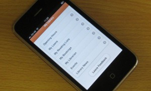
We have recently developed a mobile webApp to support access to a range of our Library services from student and staff owned mobile devices.

My Library

Library services provided via the webApp currently include opening hours, your borrowing details, reading lists, room booking information, contact details, events and library news.  It is intended that further development will take place over the coming months to incorporate new features into the webApp based upon feedback from our users.

Version 2 of our mobile webApp was released on 7th March 2013 and included the following new features:

  • Renew of loan items
  • Cancel item requests
  • Current Library PC availability (based upon the lab availability system)

Version 3 of the mobile webApp was released on the 23rd April 2013 and included the following additional features:

  • Make a room/resource booking
  • Cancel existing room/resource bookings
  • New “Library on Tour” section (with information about accessing library resources over the summer)

Lab Availability

As part of the development of a student web information portal at Loughborough University a traffic light style widget, showing the usage of our computer labs, was posited. This would offer a number of advantages with students being able to chose the lab they would head towards by seeing those which were currently, or soon to be, booked and of the available ones which were busy.

Mash

The Active Directory (AD) was the first port of call for this. Each of our labs has their own organisational unit (OU), which contains all of the machines currently in the lab. The LDAP libraries of php could then be used to scoop up the AD computer object for each machine. An AD extension attribute on each managed computer was assigned and would contain binary data. 0 would indicate that the machine was not logged into and 1 would mean the machine was busy. Attribute control is handled by LDAP Modify commands that are run as part of the log on and off processes of the PC’s. By counting the number of zeros we could tell how many of a labs machines were currently free.

More mash

first_go

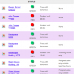
First attempt at the traffic light system

For those labs that are open access, the AD attribute control method offered all of the monitoring that was required. More work was required, however, on those labs that could be booked.

Therefore the second stage, was to question the University’s central timetabling system to see the status of the labs themselves. For this a database view was created, showing the status of the bookable labs throughout the day. SQL queries could now be sent to the view and the current and future status of the lab interpreted.

Mash with gravy

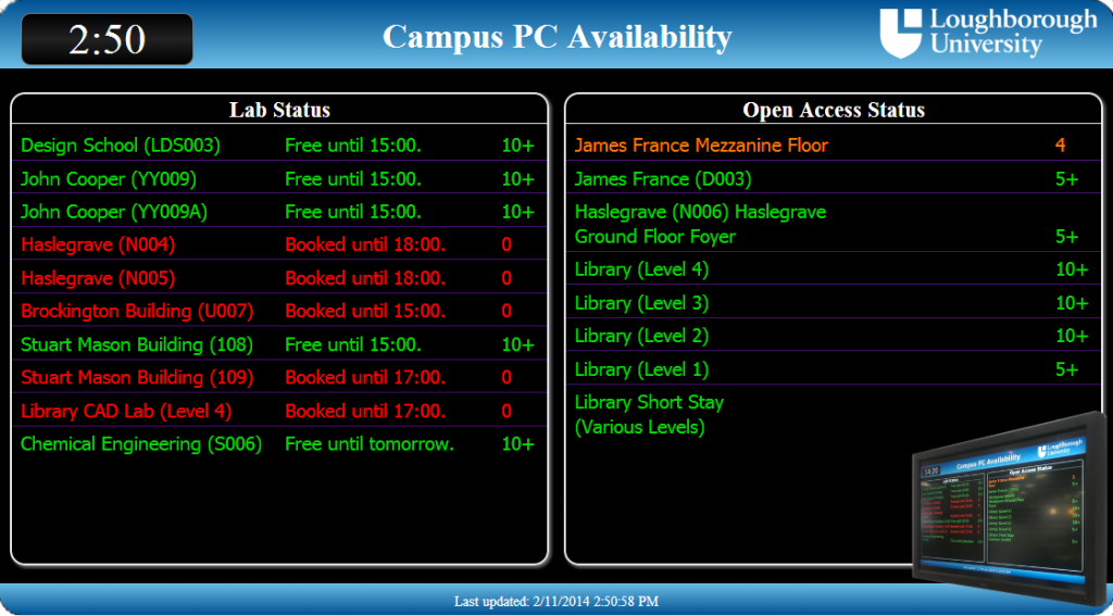
The Library uses a separate booking system (WUBS) for its seminar rooms and CAD lab. As these are not controlled from the central timetabling system, more mashup was required to connect to its API and once again poll for the daily booking data. Once this was achieved, it was simply a case of converting the WUBS API data into the same format as the central timetable data and output it all. This data could then be taken and combined with HTML5, to produce a unified traffic light display of availability throughout the campus (See our Digital Signage blog for the details).

pcAvailability

Pi and Mash. Raspberry Pi powered HTML5 mashup

What’s About

On the 6th July 2011 UK Discovery and DevCSI started running a competition to encourage the creation of tools/applications that make use of one or more of their open data sources.

Did it work? Well having looked at their open data sources I decided to create an application that would help visualise the English Heritage Places dataset and link it with the British National Bibliography dataset.  What’s About is the resulting webapp.

You can have a play with What’s About by pointing your browser at http://whatsabout.lboro.ac.uk/whatsAbout/
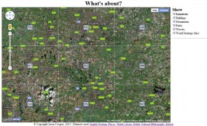
If your browser supports the W3C Geolocation API then you will initially be prompted asking if you want What’s About to know your location.  If you say yes it will use your location as the basis of the map, if you say no or your browser doesn’t support the W3C Geolocation API then the map will display around the Loughborough, Leicestershire, Nottinghamshire area, though you can move around the map and zoom in and out to look at areas that you are interested in.

The core of What’s About is the map, which takes up most of the window and the options column on the right hand side.  The options column contains a list of place types which can be used to limit down the places shown to specific types.  If there are over 100 places within the current map view then a grid is shown on the map.  A count of the number of places located within each cell of the grid is shown in the center of each cell
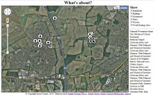
If there are less than 100 places located within the current map view then each location will be shown on the map with an icon.  The icon shows the type of place and if you hover over an icon the name of the place will appear.
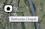
The names of the places shown on the map will also appear in the options tab on the right.  If you wish to locate a specific entry from the list clicking on its name will cause its icon to bounce up and down on the map for a few seconds.


Clicking on an icon will bring up a window with some resources for that place, including a link to the original record in the English Heritage Places dataset, a list of books with the place name contained in the title and a list of links to relevant online resources.
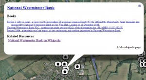
The books are taken from the British National Bibliography dataset and Related Resources links can be added by anyone using the “Add a wikipedia page” option at the bottom left of the window.  Currently only a Wikipedia URL can be entered for a Related Resource to reduce the risk of it being used to add spam, though in the long term this could be opened out to any URL provided that there were enough moderators available to remove any spam links.

There is also an extractLinks API that will return a JSON object containing the English Heritage URIs for places with attached online resources, along with the URLs and Titles for the links.
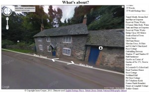
Because it is built on Google Maps technology you can also use the street view (provided there is a street view available for the area) and the icons currently shown on the map will appear in the street view helping you identify the actual places you are looking for.

The code behind What’s About is available as open source via a GPL licence.  The current version of the code can be downloaded from http://whatsabout.lboro.ac.uk/whatsAbout/WhatsAbout-1.tar.gz

Update: Well I have just found a few more bugs and also improved the street view functionality so that it now updates the places on the map as you move about.  The new version of the code is available from http://lb-public.lboro.ac.uk/whatsAbout/WhatsAbout-1.1.tar.gz

LORLS

lorlsLogoThe Middleware and Library Systems Team develop the Loughborough Online Reading List System (LORLS).

LORLS is a resource/reading list management system and has been made available as open source. It enables students to access reading lists and easily check availability of recommended resources, allows appropriate staff to create and maintain lists and informs the Library of changes made to lists to support collection development.

Further details about LORLS are available on its own website.